Dataset

MC1 Simulation Results California - 10km spatial grain

Commons Hosting
Climate Commons Hosting Status: 
Not applicable
Basic Information

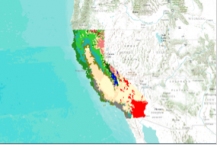
Simulations of vegetation, carbon cycle and wildfire under current and future conditions using a dynamic vegetation model (Lenihan et al. 2008) with current and projected climate used as inputs to the impacts model. Data is presented in Data Basin map galleries.

Creator: 
James M. Lenihan
Spatial Resolution: 
10 km
Temporal Coverage: 
2070-2099
Date Issued: 
2008
Notes: 

Raster data.

Parameters / Choices
A dataset often contains many geodata layers representing the same kind of measurement, but for different values of some parameters - time periods, models or scenarios, different species, etc. A value must be chosen for each such parameter in order to select a specific layer or raster which associated a single value with each geographic location (cell). The parameters or choices relevant to selecting layers from this dataset are described here.
Climate Models: 
Emission Scenarios: