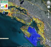
This visualization shows a color-coded representation of vulnerability to inundation by average 100-year high-water levels for different amounts of sea level rise. Does not take levees into account; areas behind levees would only be inundated if those structures were to fail.