Log In or Create Account
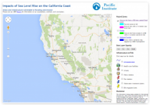
One of the first California-wide sea level rise studies, these maps provide access to sea-level rise scenarios generated by the Pacific Institute and the U.S. Geological Survey as part of the CA Energy Commission’s Public Interest Energy Research Program (PIER).
Interactive maps show the threat of inundation due to flooding over three depths based on a 100-year flood scenario starting at MHHW, areas at risk from erosion in 2100 with a 1.4 m SLR, and areas where wetlands may migrate by 2100 if unimpeded.
The site also offers downloadable static maps (as PDFs) depicting a variety of hazards from coastal flooding and thematic maps of potential impacts from sea level rise.