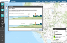
Flexible online ESRI-based mapping tool with many data layers intended for use in coastal community planning, allowing for consideration of approaches to address sea level rise adaptation for habitats and human infrastructure. Allows user to create custom maps and generate a URL to use for sharing the map and data or embed it in another website.