
About the Project: North Bay Climate Ready
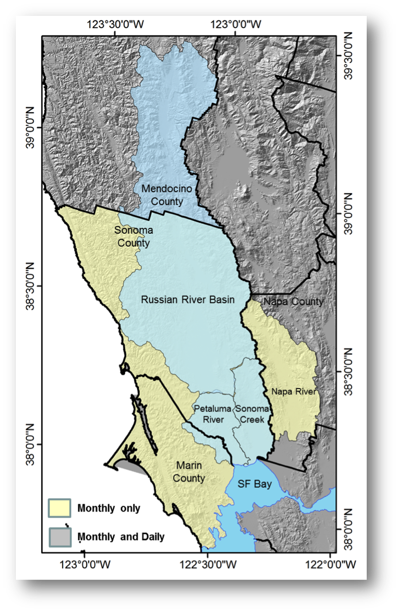 Above: Map of study region shown in blue and yellow, including regions where daily data are available for analyses (blue) and those where monthly data is available (blue and yellow). |
What is North Bay Climate Ready?
The goal of Climate Ready North Bay is to engage natural resource agencies, including water agencies, parks, and open space districts, and other municipal users to collaboratively design climate vulnerability information products specific to their jurisdictions, mandates, and management priorities. With agency input guiding the development of the vulnerability assessments, spatially-explicit data products are now available to help local governments and agency staff implement informed and effective climate adaptation strategies. These products include customized maps, graphs, and summary technical reports tailored to site-specific resource management challenges, located within the watersheds illustrated in the map at left. |
Project Partners:
North Bay Climate Ready is a project by the Terrestrial Biodiversity Climate Change Consortium (TBC3). Project partners are: California Coastal Conservancy; North Bay Climate Adaptation Initiative; Sonoma County’s Regional Climate Protection Authority, Water Agency, Regional Parks, and Agricultural Protection and Open Space District; Napa County; Marin Municipal Water District; Mendocino Flood Protection and Water Conservation District.
Project Funders:
California Coastal Conservancy, Sonoma County Water Agency, Marin Municipal Water District, Napa County, Gordon and Betty Moore Foundation.
Contact Information:
TBC3 is co-chaired by Drs. David Ackerly, UC Berkeley Department of Integrative Biology and Lisa Micheli, Pepperwood Foundation Dwight Center for Conservation Science.
Back to the North Bay Climate Ready Homepage