
Article
The Pacific Flyway Shorebird Survey
 Photo by Stuart MacKay |
The Pacific Flyway Shorebird Survey is a coordinated multi-partner research and monitoring program led by Point Blue Conservation Science designed to guide the management and conservation of wintering shorebirds in the Pacific Flyway, a migration corridor stretching from Alaska to Chile. The first phase of the effort has focused on California's Central Valley, San Francisco Bay Area, and the coastal regions of California and northern Baja California, Mexico. These regions provide critical habitat for large populations of migrating and wintering shorebirds in the Pacific Flyway. |
| This project helps answer the question: "How do changes in habitat management and climate effect shorebird populations at local, regional and hemispheric scales?" by tying together many existing monitoring efforts, establishing new ones to fill gaps, and providing the decision support tools to see the “Big Picture” of shorebird populations in the Pacific Flyway. The overall goal is to improve our understanding of trends in species populations and in the availability of the habitats they depend upon and put this information to work in real-time to manage shorebird habitats adaptively; learning more about what works and what does not each season. The result is climate-smart conservation and management that can respond and adapt actions on a year-to-year basis, to maximize effectiveness for shorebird populations despite rapid environmental change and uncertainty. | |
|
Results of the project to date include: (1) Shorebird monitoring plans for Coastal California and Northern Baja Mexico, the Central Valley, and San Francisco Bay (2) A Shorebird Data Entry Portal in the California Avian Data Center (CADC) provides a single point of entry for data from programs monitoring coastal estuaries, managed wetlands, and agricultural land (enter "demoshorebird" to test-drive the portal). (3) Interactive tools that provide summaries of shorebird monitoring data at the scale of an individual estuary, marsh, or preserve (www.prbo.org/pfss/exploredata). |
(4) Analytical capacity to iteratively use annual monitoring data in an adaptive management framework. (5) Workshops and trainings for monitoring programs throughout western North America (Canada to Mexico). (6) Implemented surveys in 10 countries in collaboration with more than 30 partner organizations. During the first 3 years of the project over 2 million shorebird observations have been entered into CADC, including almost 1 million from the San Francisco Bay survey alone. |
|
Future Work Point Blue Conservation Science plans to conduct workshops with the Central Valley Joint Venture and San Francisco Bay Joint Venture to evaluate the shorebird monitoring program, habitat modeling framework, and data summary applications. Specifically Point Blue will work with the Joint Ventures to assess how the Pacific Flyway Shorebird Survey and resulting data summary capacity can support their decision making processes. Workshops will also be held in the Sacramento and San Joaquin Valleys to engage wetland habitat managers in making the data summary and decision support products from this project work best for them. The Pacific Flyway Shorebird Survey is beginning to expand internationally under the Migratory Shorebird Project, broadening our knowledge of shorebird populations across the Western Hemisphere. For more information, contact Matt Reiter at Point Blue. |
|
| You can get involved! Citizen scientists and partner biologists are helping figure out how large-scale environmental changes, like urbanization, extreme weather, climate variation as well as agricultural flooding, wetland restoration and management, are affecting shorebirds and their habitats throughout the Pacific Flyway. See the Pacific Flyway Shorebird Survey website to learn how to be part of this exciting project. |
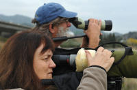 Photo by Frankie Frost |
Last Updated:
11/2013